
A shortest route over the Earth can look curved on a flat map
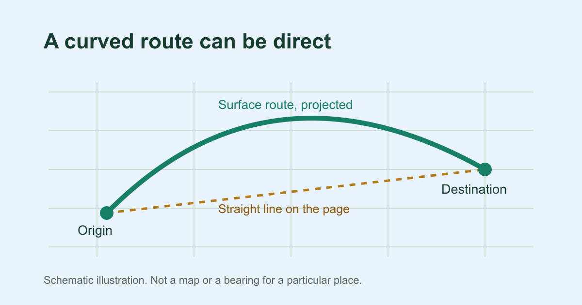
The Earth's surface is curved, and no flat map can keep every distance, angle and shape correct at the same time. Each map projection makes its own trade-offs. On a spherical model of the Earth, the shortest route between two places is called a great-circle route. On a world map, that route often appears as an arc.
A globe and a piece of string show the idea well. Pull the string tight between two cities on a globe and it follows the shortest path. Copy that same path onto a familiar world map and it often bows towards the nearer pole. A line that looks straight on the flat sheet is not automatically the shortest route over the Earth.
Google's help page on curved map lines gives the same projection explanation for routes drawn on its maps.
Why Toronto's Qibla starts northeast, not southeast
Many people in North America are surprised that their Qibla points northeast. On a typical world map, Makkah sits to the east and well to the south of Toronto, so southeast seems natural.
Take the Toronto city preset, an approximate city-centre point at 43.6532, −79.3832. From there, Qibla Finder Online calculates a spherical initial bearing of 54.6° from true north, which is northeast. The target is the Makkah reference point at 21.4225241, 39.8261818. Over the spherical Earth model, it is about 10,496 km away. The shortest route leaves Toronto heading northeast and climbs to higher latitudes over the North Atlantic. It then curves southward as it continues towards Makkah.
That figure belongs to the city-centre point. Your own address in or around Toronto may give a slightly different result. The Toronto Qibla reference shows the full worked example.
Globe
Mercator view
A straight screen line answers a different question
On a common world projection such as Mercator, a straight ruler or screen line from Toronto to Makkah runs south of east. That line is not the shortest route over the Earth, and it does not give the route's starting direction. On a Mercator map, a straight line keeps one constant bearing from true north the whole way. That is a different kind of path, called a rhumb line.
Not every projection curves every great circle. A route plotted point by point along the great circle, like the line on the finder's optional map, is a faithful drawing of the shortest route, even though it sits on a flat surface. Takeaway: take your direction from the calculated starting bearing and a trusted local north reference. A straight line across a world map can point a different way, so do not rely on it.
The direction at the start is the one you apply
The finder reports a spherical initial great-circle bearing. This is the angle at which the shortest route leaves your selected starting point, measured clockwise from true north. On this scale, 0° is true north, 90° is east, 180° is south and 270° is west.
Along a great circle, the local heading generally keeps changing. The Toronto route starts at 54.6° but reaches Makkah from a quite different direction. So the far end of a map line, or its overall slope, does not tell you which way to face. Only the angle at your own position does. For background on initial bearings and rhumb lines, see these notes on latitude and longitude calculations.
This is a geographic calculation on a spherical model of the Earth. It is not a surveyed alignment of any building, and it is not a religious ruling. Questions about how precisely the direction must be followed belong with a qualified scholar.
A curved map line does not move the phone arrow
A curved route does not mean the finder is pointing somewhere else. The curve is only how the map draws the route, and the calculated bearing for your starting point stays the same. By default the dial uses the North-up view. It shows the bearing from true north without reading any sensor, so it can stay still while you move the phone.
The direction your phone is facing, called its heading, is a separate measurement. The finder uses it only after you choose Enable live compass. It also needs the browser to provide a known magnetic heading. The finder corrects that reading once for the local magnetic declination, so it can be compared with true north. It does not accept an orientation reading whose reference is unknown.
Hold the phone flat or nearly level, within about 5°, with the screen in portrait orientation. Live alignment pauses if the phone tilts further or turns to landscape. It also pauses when a valid magnetic correction is unavailable. If live mode is paused or unavailable, use the degree value with an independent north reference.
Some movement while you turn the phone is expected. If the number stays steady but the arrow drifts or jitters while the phone is still, check the heading, not the route. The usual causes are permissions, sensor support, nearby magnets or metal, and the way the phone is held. You can troubleshoot the device arrow step by step.
From map to room: apply the bearing with a north reference
In your room, use the starting bearing. Do not try to trace the drawn route.
- Get the bearing for your starting point. Use your actual location or a suitable nearby reference point. Note the degree value shown from true north.
- Find true north with a reliable reference. An ordinary magnetic compass points to magnetic north, which differs from true north by the local magnetic declination. Adjust for that difference once before you turn. If your compass is already set to true north, make no adjustment.
- Turn clockwise from true north by the stated number of degrees. A north-up local map can help you match the direction to a road or wall you recognise. First check that the map has not been rotated.
In the finder, Open map shows the selected point and its direction on a map. The map is optional. Loading its OpenStreetMap tiles shares your IP address and the area you are viewing with the tile provider.
Neither the number nor the map measures your walls, your room or the way your body faces. The step-by-step guide shows how to apply the bearing with a north reference, including how to convert the bearing for a magnetic compass.
Check the calculation or try another starting point
The calculation takes the latitude and longitude of your starting point and of the Makkah reference point. It treats the Earth as a sphere with a radius of 6,371.0088 km and works out the initial great-circle bearing between the two points. The notes on great-circle calculation and map projection cover the formula and the reference point in more detail.
To try another starting point, search the city presets or enter decimal coordinates under Enter coordinates instead. You can also choose Use my location. If your city is not among the presets, that does not mean your area is unsupported. Coordinates or the map's Use map centre option will work instead.
The finder asks for your device location only after you tap Use my location. It reads the location once rather than tracking you. Remember this location on this device is off on first use. The finder keeps your selected point for later visits only if you tick it. Links you open or share can still stay in your browser history, and a coordinate link shows its coordinates to anyone who receives it, while a city link shows only the city name and country.